The purpose of the project is to identify and analyze the long-term changes in the settlement and the economy of the area in relation to the various environmental factors that shape the different landscapes of Thrace. In this way we hope to be able to draw some preliminary conclusions concerning the strategies behind the development of new (urban and rural) settlements in different environments across the area.
In this regard, we tried to combine the wealth of recorded written – historical – information with the multitude of archaeological, geological, meteorological and palynological information derived from systematic research in the area over the last hundred years. This convergence and its processing through integrated, autonomous digital platforms (such as QGIS) seems to promise the construction of an environmental history of the region, which will take into account the use or misuse of natural resources, the evolution of different landscapes, of the demographic – residential and mainly of the “interconnection” that seems to characterize the human activity in the area.

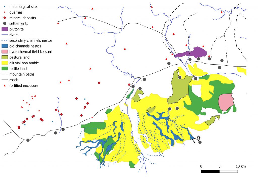
Crucial thus in our research was the development of a GIS platform to facilitate the integration of a wide range of hydrological, geological and meteorological information from different sources (other databases, field tests, etc) and different formats( e.g. digital data, maps etc) into a logical and consistent structure. The geospatial database has been developed in the open access QGIS software the advantages of which like transparency of code, openness to public scrutiny, public availability, portability, transferability and support by a growing online community has provided us with a research tool that with minimal effort and no costly private licenses can be available to anyone who is willing to phrase the appropriate questions over any set of data. The platform was designed to analyze and visualize different environmental data and field test results implemented in the area. Within this context contour maps and spatial operations of soils productivity and site distribution have been generated using customized queries.
