
Kalapodi and its region in the Roman period
Kalapodi, in central Greece between Delphi and Atalanti, is the location of a major multi-period sanctuary identified with the oracle of Apollo at Abai. Excavations by the Ge rman Archaeological Institute (DAI) since 1973 have revealed a long cult sequence from the Late Bronze Age to Late Antiquity. In the Roman period the sanctuary remained active, underwent refurbishment, and—based on epigraphic and geophysical evidence—appears to have developed into an urban settlement area around the cult centre. Its position in a borderland zone between Phokis and East Lokris placed it at a strategic crossroads, controlling routes between northern and southern Greece and linking the North Euboean Gulf with inland corridors toward the Corinthian Gulf.

Why Pottery?
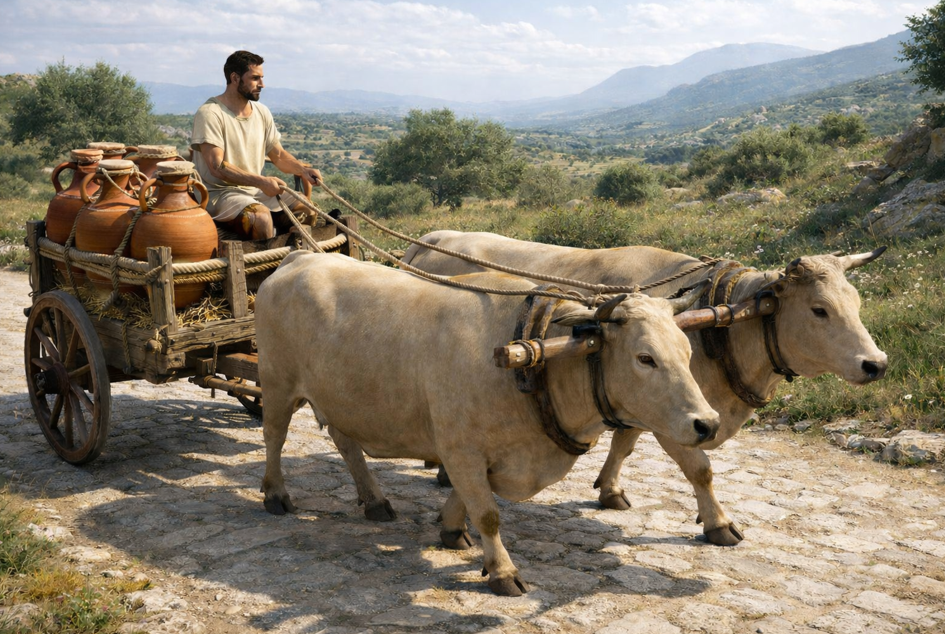
Roman pottery—amphorae, fine wares, and other ceramic categories—offers one of the most robust archaeological datasets for tracing movement, exchange, and connectivity. The wide circulation of mass-produced wares across the Mediterranean makes pottery a valuable proxy for studying economic integration, regional consumption patterns, and shifting supply routes. Imported ceramics at inland sites, sanctuaries, and cities provide tangible evidence for how goods entered a region, how they circulated, and which places acted as hubs within broader systems of exchange

A combined approach: Networks + GIS
This project integrates Social Network Analysis (SNA) with Geographic Information Systems (GIS) to explore the regional economy around Kalapodi during the Roman period. Network analysis helps identify which sites are most strongly connected through shared pottery imports and which nodes may function as “bridges” in wider distribution systems. GIS adds the critical spatial dimension: the physical landscape, transport corridors, accessibility, and the relationship between inland sites and coastal entry points. Together, these tools offer a powerful framework for reconstructing trade and mobility beyond simple maps or isolated distribution lists

Data and Scope
The dataset focuses on imported Roman fine wares and transport amphorae from Kalapodi and a wider “core region” including sites in Phokis, East Lokris, and northern Boeotia. Because pottery publication in the region is uneven, the analysis relies primarily on occurrence-based criteria (presence/absence) and is designed to be adaptable as new material and quantification become available
Network modelling across time
The study employs both 2-mode (bimodal) and 1-mode network models. In the 2-mode model, one set of nodes represents sites and the other represents pottery types; links reflect the presence of a ware at a site. In the 1-mode model, only sites are retained, and connections are weighted based on the number of shared imports—allowing comparison of similarity and connectivity among sites. Key metrics such as degree centrality and betweenness centrality are used to explore relative importance and intermediary roles within the network.Results are discussed across three broad phases—Early, Middle, and Late Roman—showing that connectivity patterns and potential supply directions changed over time. In the Early Roman phase, Kalapodi appears particularly well positioned as an intermediary (“bridge”) for imports within the regional network. In later phases, the network becomes more balanced, suggesting that imports could circulate without necessarily passing through a single dominant hub

What networks can—and cannot—tell us
Network analysis is effective for identifying likely hubs, intermediaries, and clusters of similarity in pottery supply. However, it cannot by itself explain motivations, decision-making, or the lived realities of transport (cost, risk, seasonality, institutional control, or social drivers). It also cannot measure the full scale of trade when quantitative data are missing. These limits make it essential to complement SNA with spatial modelling and hypothesis testing. PalgraveEconHist_article_Grigor…
Extending the analysis with GIS and Least Cost Paths
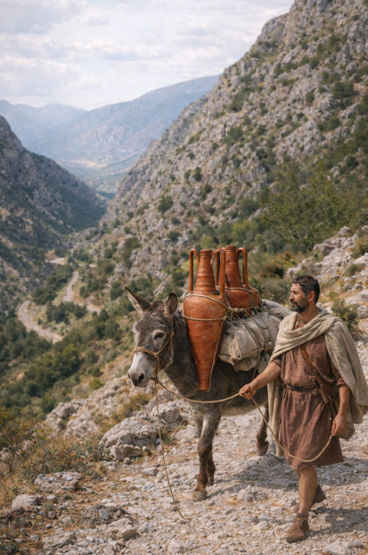
To move from connectivity patterns to movement hypotheses, the project applies GIS methods including Least Cost Path (LCP) analysis and service area modelling. Landscape modelling and cost surfaces are used to reconstruct plausible inland routes between ports and Kalapodi, especially where direct archaeological evidence for roads is limited. Service areas based on travel-time/day-distance estimates help evaluate which harbours could efficiently supply Kalapodi. The GIS results highlight the role of major nodes such as Chalkis and Corinth as transshipment hubs and underscore the importance of multiple coastal entry points and inland corridors linking the Corinthian and North Euboean Gulfs.
Beyond Static Models: Agent-Based Modelling
While network analysis and GIS are powerful tools for identifying patterns of connectivity and reconstructing possible routes, they still represent relatively static analytical frameworks. To explore the dynamic processes underlying the movement of goods, the project also considers the potential of Agent-Based Modelling (ABM).
Agent-based modelling simulates the behaviour of individual actors—such as traders, transporters, or pilgrims—moving through a landscape and interacting with one another. Each agent follows a set of simple rules that determine how decisions are made, for example which routes to take, how far to travel in a day, or which markets to visit. When many agents interact within the same environment, complex patterns of movement and exchange can emerge. This approach allows researchers to explore how individual decisions and environmental constraints might collectively shape larger economic systems.
In the context of the Kalapodi project, ABM offers a way to test hypotheses about how goods may have moved through the regional network. For example, simulations can explore how traders might choose between different harbours, how seasonal travel constraints or terrain might influence route selection, and how pilgrimage traffic to the sanctuary might intersect with commercial exchange. By combining ABM with GIS-based route modelling and network analysis, it becomes possible to investigate not only where goods could travel but also how different actors might have navigated the landscape and interacted within the economic network.
Presentations
- 12/2025 Evangelidis, V. Extending the Potentials of Landscape Archaeology: From GIS to ABM. Lecture Series Atlas.
- 02/2025 Evangelidis, V., D. Grigoropoulos, C. Kiourt. 3D Environment Multiagent Simulation: Tracking Movement and Trade in Roman Greece. Conference Three-Dimensional Experiences of Ancient Environments, American School of Classical Studies at Athens & Case Western Reserve University.
- 11/2024 Kiourt, C., Evangelidis, V., Grigoropoulos, D. Agent-Based Simulation of Crowd Movements in Uneven Terrains: Archaeological Case Studies. Conference Archaeo-Informatics 2024: Use and Challenges of AI in Archaeology.
Publications
Grigoropoulos, D., & Evangelidis, V. “Exploring Pottery Distributions and Regional Economies through Network Analysis and GIS: Kalapodi and Its Region in the Roman Period as a Case Study.” In M. C. Schisani, G. De Luca, G. Ragozini & P. Cimadomo (eds.), Network Analysis for Economic, Business and Financial History: Methodological Advances and Applications. Palgrave Macmillan, Palgrave Studies in Economic History (forthcoming).